
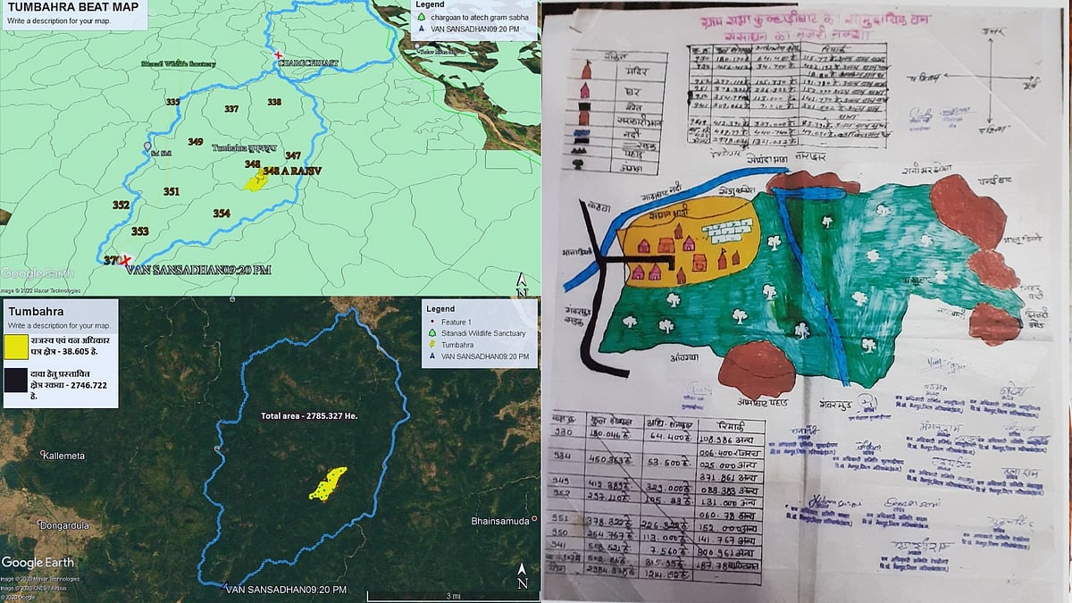
In the early 2000s, a group of foresters walked into the village of Nagesh in Gariaband district, Chhattisgarh, carrying a set of maps. They conducted a mini-survey and then proceeded to plant munaras, or posts, throughout the village. Some posts were planted in vacant spaces shared by two or more households of the Bhunjiyas – a community categorised as a Particularly Vulnerable Tribal Group in Chhattisgarh, owing to their declining population, high poverty rates, and fading culture.
"When we asked the foresters why they were doing the same, they simply told us that they were trying to decipher the real border of the forests," Arjun Singh Naik, a local leader and former village head, or sarpanch, told me. The households that fell on the 'wrong' side of the border were warned of eviction. Time and again, members of these households have had to travel to the district headquarters, nearly two hours away by foot, to plead their case with forest officials. There, a forester invariably rolled out a map, pointed to a thin line and justified the existence of the forest in a way that made the Bhunjiya presence feel like an accident or mistake. The lines on the map were made to appear as acts of god and not the government. Perhaps this is why the radical geographer John Brian Harley contended that maps "exert a social influence through their omissions, as much as by the features they depict and emphasise."
Two decades later, the same communities are using digital maps to impose a different meaning on the landscape from the one asserted by the government. Scholars in fields such as critical border studies and critical cartography liken this to an exercise in 'counter-mapping.' In the context of Indonesia, the rural sociologist Nancy Lee Peluso describes counter-mapping as the appropriation of mapping technologies in a way that "increase(s) the power of people living in a mapped area to control representations of themselves and their claims to resources." In Chhattisgarh, one grassroots organisation, Khoj Avam Jan Jagriti Samiti, has empowered Adivasis to deploy geographic information systems in their bid to resist, contest and redefine the borders imposed by the postcolonial Indian state.
The power of maps