
(This article is a part of the web-exclusive series from our latest issue 'Disaster Politics'. More from the print quarterly here.)
The road to the village of Gulzarpora from Kakapora in the Pulwama district of south Kashmir winds its way up and down hilly orchard country. Around us are terraced plateaus called Karewas – humped, clay deposits about 300 metres high. The Karewas are a product of a Pleistocene-era earthquake, which caused the ancient Satisar Lake to drain away, revealing the Jhelum Valley between the folds of the Pir Panjal and the Greater Himalayan mountain ranges. All along one side of the road are tangled barbwires. A few kilometres ahead, we see a high sound-proofed grey metal fence interrupted by watchtowers. This is the Indian Air Force's massive Awantipora (Koil) Airforce Station, built on the Karewa uplands of Quil and Malangpora. Like most large military installations in Kashmir, it is built on higher ground and overlooks the town of Awantipora like a panopticon. On the other side of the road lies the ten-foot-high embankment of the 'strategically important' Jammu-Baramulla railway line. This runs roughly parallel to the left bank of the river Jhelum (historically more prone to breaches) bifurcating the whole valley longitudinally. Flanked by the air-force base on one side and the railway line and river on the other is the beleaguered village of Gulzarpora – our destination.
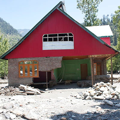
Given the elevation and the terrain, Gulzarpora seems an unlikely place for stagnating water. But the surrounding land is a marsh of rotting apples and plants, and the few concrete walls that remain standing all bear the telltale mark of the flood line. This, even when we visit six weeks after the India-Pakistan floods of September 2014, which killed 557 people and submerged about 2600 villages in India-administered Jammu & Kashmir alone.
The sweet putrid smell is over powering. Like most residents in other flooded villages in south Kashmir, the inhabitants of Gulzarpora unequivocally blame the unprecedented water levels and the prolonged inundations of the floods of September 2014 on the railway embankment. The Masjid Committee chairperson, Manzoor Ahmed Wani of the neighbouring village of Beighpora said, "We've never known such a flood before. Even though we're close to the river, in the past, during the worst of floods, the water always drained away immediately. When they were building the [railway] line, we told them many times – what will happen to the water, when the snow melts and our nallahs are full? Where will the waters go? They have to join the Jhelum – you don't have to be an engineer to know that. Water always finds a way, and now its way is blocked." The floodwaters this time was nearly ten feet high and Gulzarpora remained cut off for over two weeks. About a hundred of its 300 mud-and-brick houses collapsed, while the rest were seen tilting on damaged foundations and sunken floors. Villagers rooted around the debris of their homes and cowsheds, looking to salvage their belongings. Electricity took a month to return because of the prolonged inundations, and the village was being supplied water by a daily tanker that was parked some distance away at the road-head. The railway embankment had been cut at strategic spots with earth-moving equipment hired by the community, before the waters could finally drain away enough to allow them to enter their houses.