
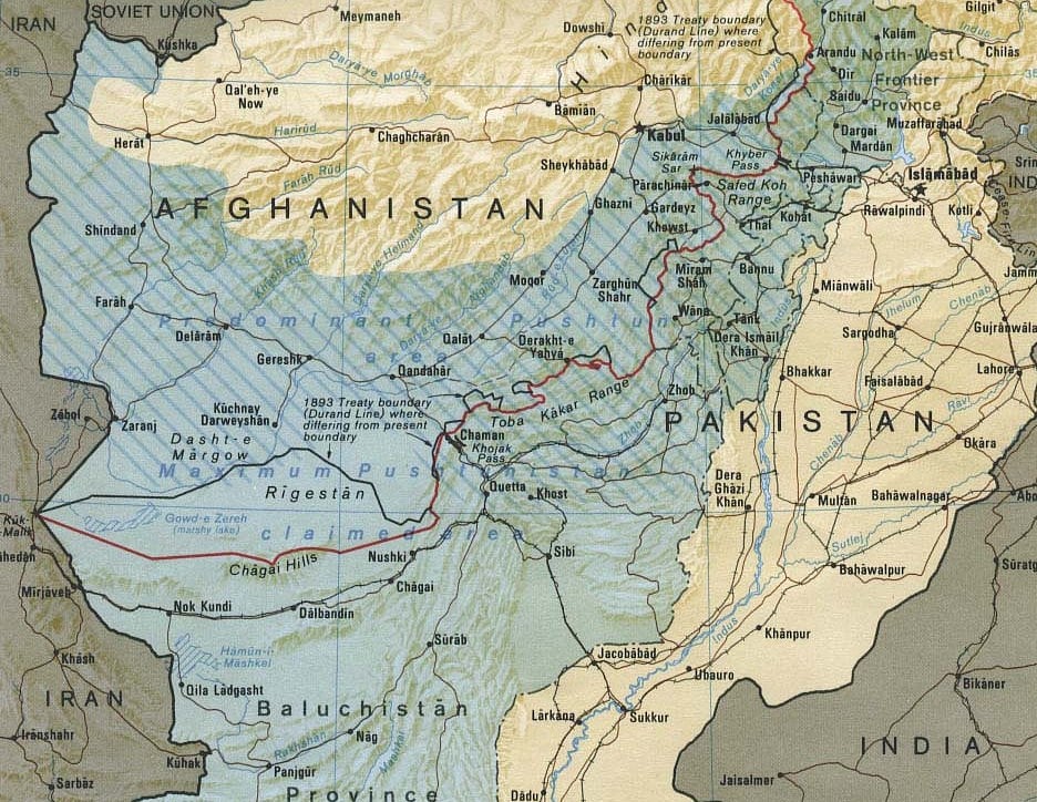
If a border isn't recognised by those on either side, does it still exist? That has long been the burning question along the Durand Line, the 112-year-old frontier between Pakistan and Afghanistan.
In theory, there is a border. Customs and immigration officials check passports and IDs at crossing points. Smugglers smuggle. There is an elaborate, twisting ballet at the frontier as vehicles switch sides on the road, driving from the left side in Pakistan to the right in Afghanistan. What more obvious way to denote a different country?
But a different country is not that evident elsewhere along the frontier, away from the official border posts. Most of the Durand Line goes through remote, uninhabited terrain – the High Pamirs in the far north, down through the snowbound Hindukush and into the Spin Ghar range. This last has been made recently infamous as a battleground between Osama bin Laden and the US military, ever since the 2001 attacks in New York and Washington DC. Thereafter, mountains give way to dust devils and deserts, with occasional moon-rock outcrops, all the way to the border with Iran.
No customs officers man gates along these stretches. No signs welcome visitors or urge caution on the highways. Instead, more than six million Pashtun tribal people live in these villages, valleys and occasional towns, refusing to tolerate any notion of a border. To them, this is Pukhtoonkhwa, Pashtunistan, their homeland; part of Afghanistan perhaps, but definitely not, on pain of death, to be considered Pakistani.